Have an account?
Log in to check out faster.
Loading...
Shop New and Pre-Owned Boats
Free shipping on orders over $100*
Waterproof Charts, Inc.
Couldn't load pickup availability
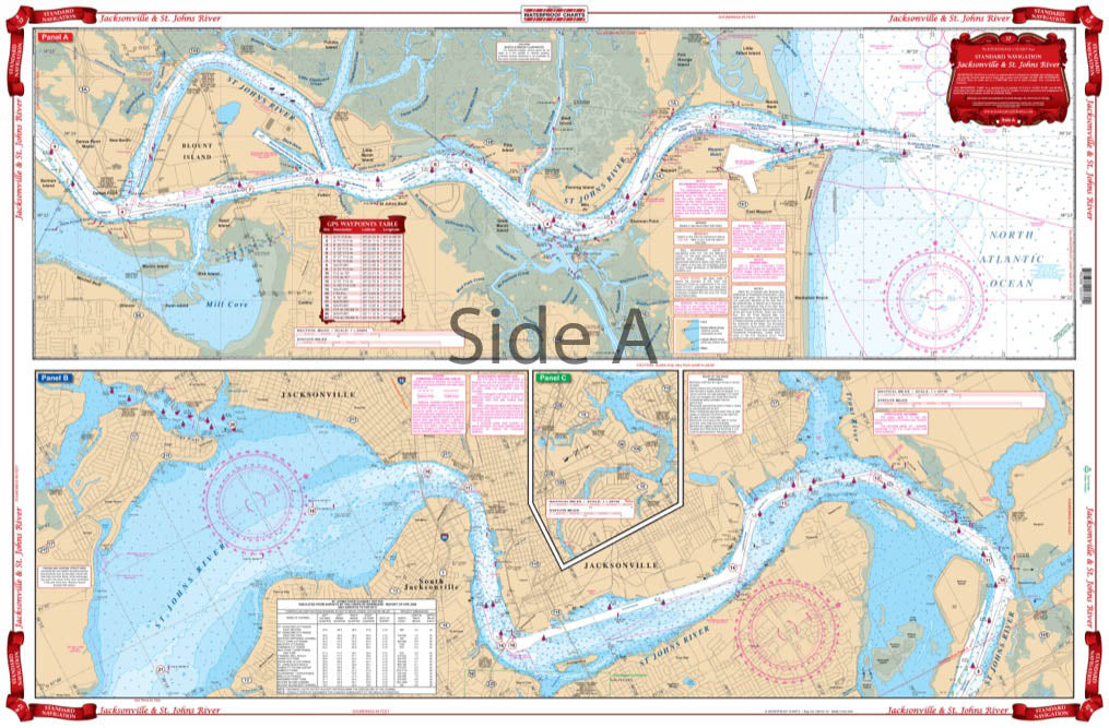
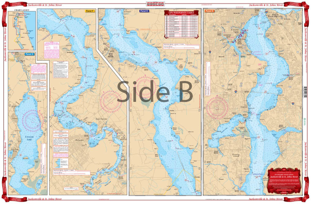
Lower St. Johns River
Starting at the Atlantic Ocean, this chart covers up the St. Johns River to city of Jacksonville, continuing upstream through Green Cove Springs, Palatka, covering Murphy and Dunn Creeks and includes all of Crescent Lake.
Be the first to know about new items and exclusive offers.
Be the first to know about new collections and exclusive offers.