


Waterproof Charts, Inc.
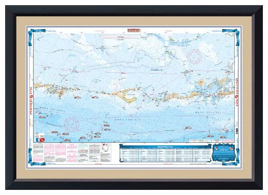
Waterproof Charts 38 North Bahama Islands Standard Navigation
Waterproof Charts 38 North Bahama Islands Standard Navigation
Couldn't load pickup availability
North Bahama Islands
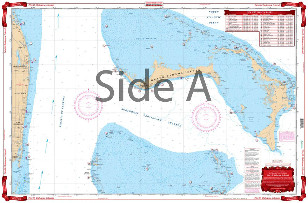
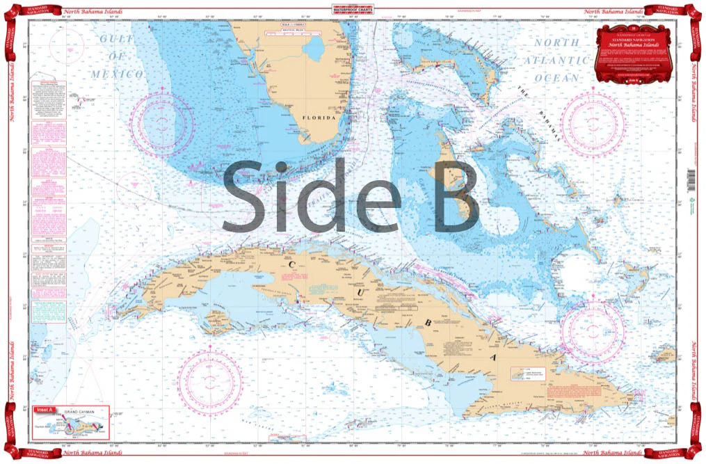
Side A is an enlarged projection of FloridaÕs South East Coast from Stuart south to Elliot Key and east to include the Abacos Islands and south to include the Bimini and Berry Islands. Side B includes South Florida, Cuba, and the Bahama Islands south and east to the northwest coast of Haiti. This is a great chart for planning your trip to the Abacos or anywhere in the Bahamas. This Chart of the Bahamas needs to be in your Chart Drawer. ÊSide A is an enlarged projection of FloridaÕs South East Coast from Stuart south to Elliot Key and east to include the Abacos Islands and south to include the Bimini and Berry Islands. ÊSide B includes South Florida, Cuba, and the Bahama Islands south and east to the northwest coast of Haiti. This is a great navigation chart for planning your trip to the Abacos or anywhere in the Bahamas. You will be able to expertly journey from Florida to the Bahamas with ease.
Share
Subscribe to our emails
Be the first to know about new items and exclusive offers.