


Waterproof Charts, Inc.
Waterproof Charts 9F Sanibel to Lower Keys Fishing Offshore Fish & Drive Chart
Waterproof Charts 9F Sanibel to Lower Keys Fishing Offshore Fish & Drive Chart
Couldn't load pickup availability
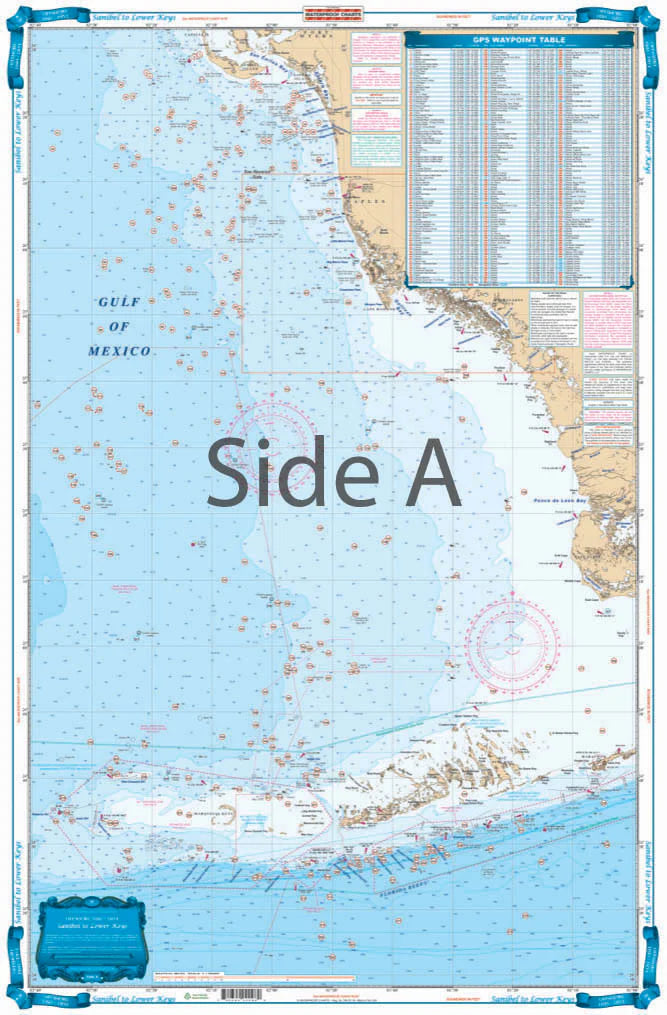
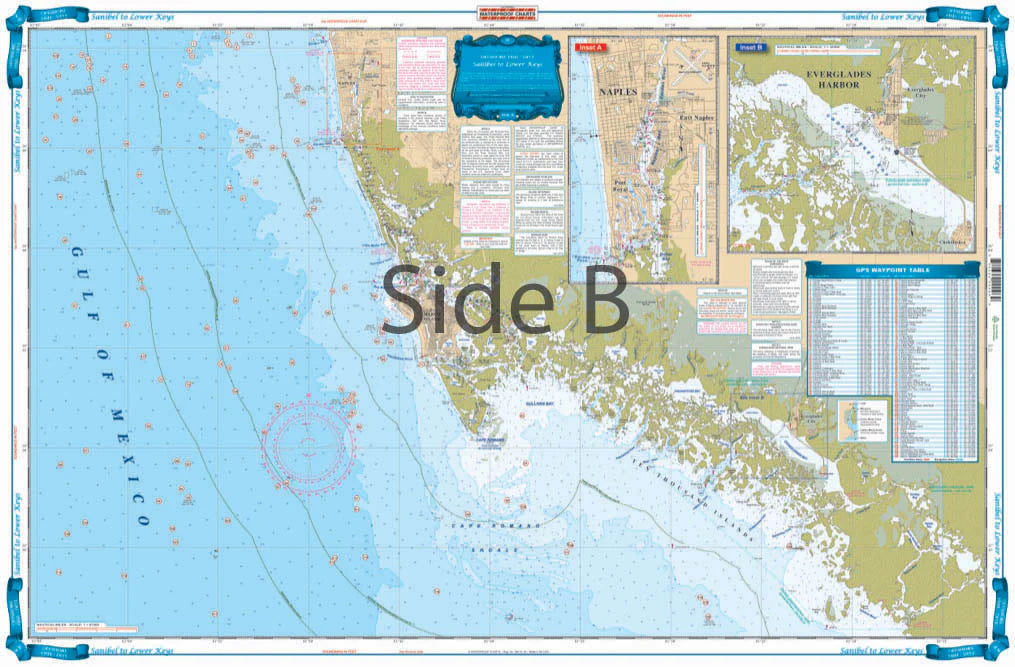
Sanibel To Lower Keys
Offshore Coverage from Sanibel south to 20 miles south of Key West, east to Marathon and west to 82 degrees 40 minutes (Rebecca Shoal). Reverse Side is Coastal Coverage of Naples south to Pavillion Key offshore to 82 degrees 5 minutes. Details for Naples Ð Gordon River and Everglades City. A total of 369 Plotted and Indexed GPS Positions for reefs, wrecks, lights, fishing and diving locations. You wonÕt ever want to go fishing without this Southwest Florida fishing chart. Offshore coverage runs from Sanibel south to 20 miles south of Key West, east to Marathon and west to 82 degrees 40 minutes (Rebecca Shoal). The reverse side of this navigation chart provides coastal coverage of Naples south to Pavillion Key offshore to 82 degrees 5 minutes. This marine map also has detailed insets are included for Naples to the Gordon River, and Everglades City. A total of 369 plotted and indexed GPS positions for reefs, wrecks, lights, fishing and diving locations, helping you find more fish!Ê
Share
Subscribe to our emails
Be the first to know about new items and exclusive offers.