


1
/
of
2
Waterproof Charts, Inc.
Waterproof Charts Clearwater Beach to Egmont Key Large Print Navigation Chart 31E Map
Waterproof Charts Clearwater Beach to Egmont Key Large Print Navigation Chart 31E Map
Regular price
$28.95
Regular price
Sale price
$28.95
Unit price
/
per
Shipping calculated at checkout.
Couldn't load pickup availability
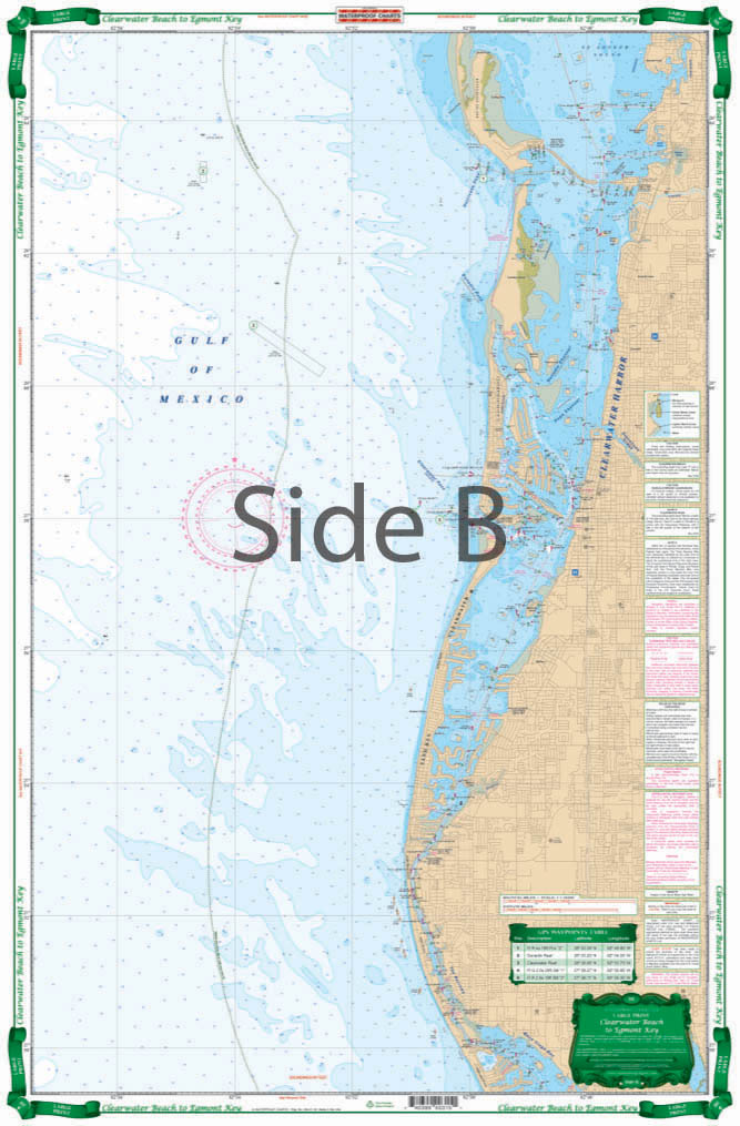
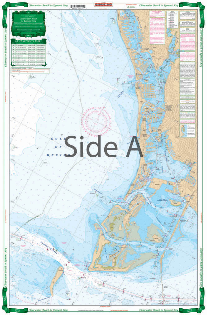
Large Print Charts Clearwater Harbor to Egmont Key
Shows detailed Intracoastal Waterways area from Egmont Key to Sunshine Skyway and North to Clearwater Harbor and Honeymoon Island. Large Print Place Names make areas and inlets easy to find. A total of 15 GPS Waypoints. Covers area From 3 to 6 Miles Offshore as well. You may regret having bought your fancy GPS unit, but you’ll never regret this Clearwater nautical chart. This chart shows detailed intracoastal waterways area from Egmont Key to Sunshine Skyway and North to Clearwater Harbor and Honeymoon Island.
Share
Subscribe to our emails
Be the first to know about new items and exclusive offers.